Spatial Analytics
At BNOSAC, we use spatial data mining to discover interesting and previously unknown spatial patterns in large datasets. The service line spatial data mining executes exploratory spatial analysis, we create Web Map Services(WMS), perform geomarketing analytics, do analysis of recorded GPS log trackings, create custom based interactive maps, provide data enrichments or perform advanced geostatistics.
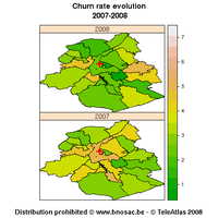
Business Mapping and geostatistics
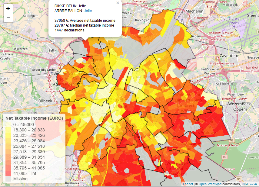
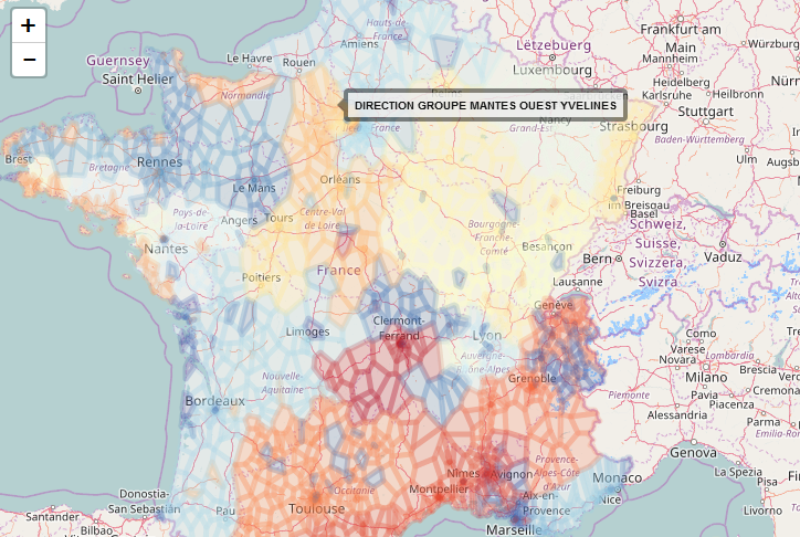
If you are interested in simple mapping of geostatistical data in order to know the best potential of new sites, to optimally leverage your promotions or to see how your customers behave on a certain campaign in your area of interest, we can help you. We make geomarketing maps of your data tailored to your needs. Our mapping tools allow you to visually see where you can boost your sales with a minimal marketing effort.
Geocoding
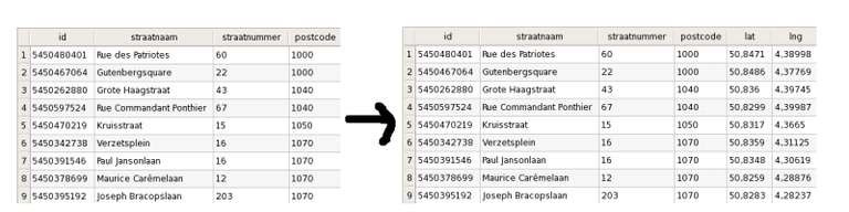
Geocoding refers to adding lattitude and longitude coordinates to addresses of customers in your database so that they can be plotted. BNOSAC offers gecoding services freely if other analytical services are included in the contract. Mail us so that we can contact you to supply you with more detailed information.
Open Data about Belgium
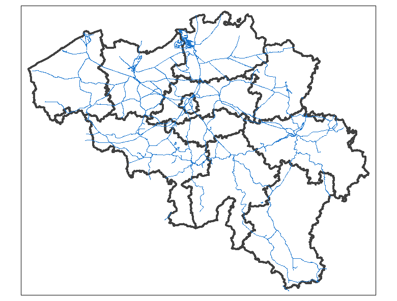
BNOSAC provides open data about Belgium in any suitable format. A number of open source R packages for this are made available at https://github.com/bnosac/BelgiumMaps.StatBel and at https://github.com/weRbelgium.
|
|
|
|
If you want more detailed information about the possible data which can be provided for your business, mail us so that we can contact you to supply you with more detailed information.
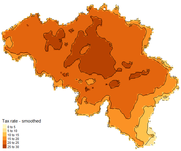
Data Enrichments & Web Map Services
Having latitude/longitude pairs or data from OpenStreetmap is just the beginning of your spatial journey. You are probably interested in other elements like what part of the country do our branches cover, who is living there and what do they do. We set up new data enrichments and maps and provide you the shape files. So that these mapping solutions can be included at your intra- or internet for a wider audience. We help you set up these web map services and provide analytical geostatistics & data manipulation. Contact us if you want to discuss the requirements of your project.
GPS log analysis
Do you want to know where your customers live, how they move, which places interest them and what they do there and you want to know how you can target them better and more efficiently, we are there to help. We analyse GPS logs and set up predictive models to improve customer experiences.
Training
We give training in spatial analytics using open source tools. This training covers the following topics.
- Importing spatial data and setting the spatial projection
- Plotting spatial data on static and interactive maps
- Adding graphical components to spatial maps
- Manipulation of geospatial data, geocoding, distances, ...
- Density estimation and spatial point pattern analysis
- Spatial regression
- Kriging and spatial predictions
More information can be found here.